
- Distance of tour : 23 km
- Hardness of tour : Könnyű
- Levels : +354 m,-354 m
- Average slope: 2.3 %
Before you start...
Cycling in the forest is regulated by the law, and these rules can
change. Before you go on your hiking or riding tour, please check current forest law and start riding only if it is permitted.
- Distance of tour : 23 km
- Hardness of tour : Könnyű
- Levels : +354 m,-354 m
- Average slope: 2.3 %
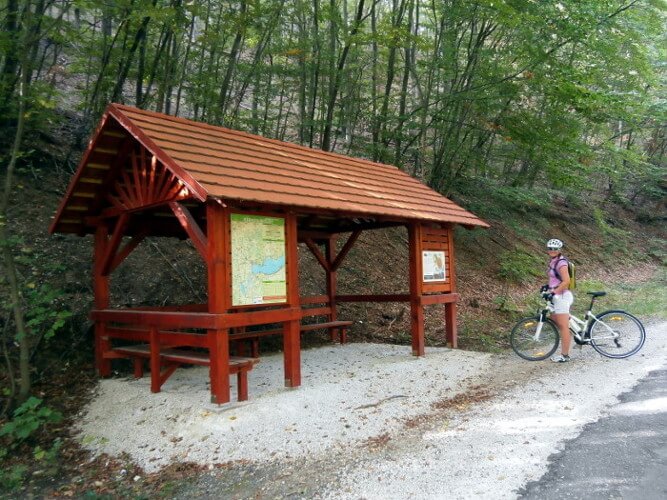
The Keszthely Mountains waits for its terrain bikers as well. The two most important dirt roads are shown on the map, with three rest stops. From Keszthely we cycle further along the Balaton bike path to Gyenesdiás.
From here we can continue for a while on the pleasant red hiking trail in the forest (resting place: Hatlábú Pajta), then we continue straight on to the asphalted forest road, where we turn right to Büdöskút resting place.
After the resting place, we can cycle down following the green sign to Vonyarcvashegy. (resting place: Cseri Kapu). Anyone can use these paths, but a helmet is a must here!
From Vonyarvashegy to Keszthely we cycle on the bike path, touching Gyenesdiás.
Ajánlott kiadványok
 Turistatérképek |
 Túrakalauzok |
Támogasd a működésünket
Ha tetszett a cikk, kérlek támogasd a munkánkat önkéntes adománnyal a Revolutos számlánkra bankkártyás fizetéssel. Ezáltal még több hasonló cikket fogunk tudni készíteni a szórakoztatásodra.
Hogyan működik az adományozás?
Köszönjük!